Innovate UK ADOPT Facilitator
Approved ADOPT facilitors for collaborative farmer-led, on-farm trials or experiments to generate, test and demonstrate innovative solutions to farming challenges
Biodiversity Net Gain (BNG) Facilitator
Providing end-to-end BNG compliance for landowners and developers including project oversight and metric calculations.
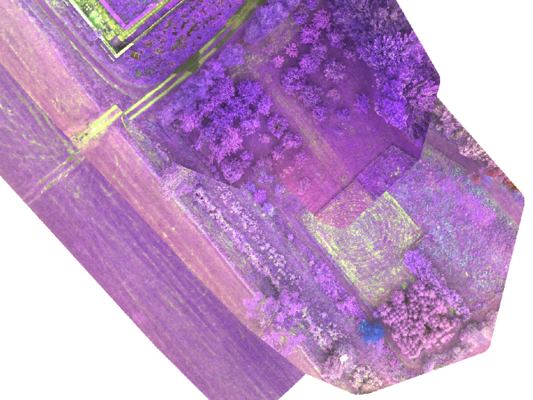
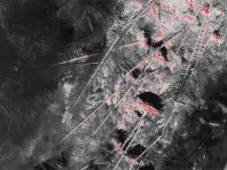
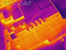
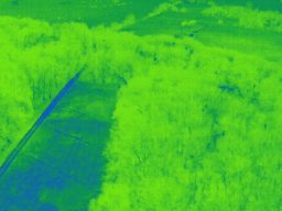
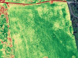
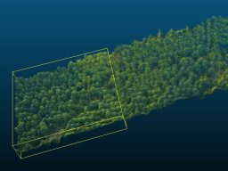
Landscape Photogrammetry, Multispectral Analysis, and Thermography
At Akivita Ltd we leverage state-of-the-art drone technology and software systems to deliver comprehensive landscape photogrammetry and thermography services. Our advanced aerial imaging capabilities allow us to offer detailed analyses for a variety of environmental assessments.
Our drone-based photogrammetry and thermography services are tailored to meet the specific needs of our clients, ensuring precise data collection and analysis for informed environmental decision-making.
Example Applications Include: River Hydrology, Deer Counts, Nesting Birds and Crop Health
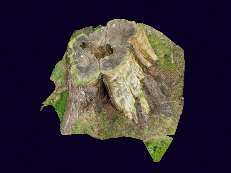
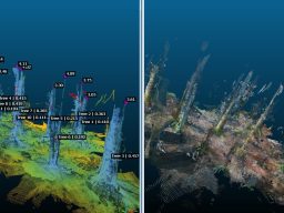
3D Modelling of Sites, GIS Mapping and Analysis.
At Akivita we offer advanced geographic information systems (GIS) mapping and analysis alongside 3D modelling services to provide comprehensive site assessments and visualisations. Our expertise in GIS and 3D modelling enables precise data interpretation and detailed environmental insights.
Our GIS mapping and analysis, along with 3D modelling services, are designed to meet the unique needs of our clients, ensuring precise data collection and interpretation for informed decision making.
Example Applications Include: Site Planning and Development, Environmental Impact Assessments, and 3D Terrain Modelling.